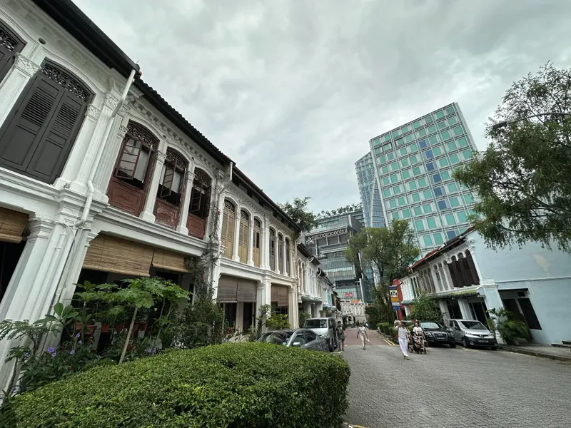
Conservation shophouses are the hardest kind of small building to document well. The floor plates are narrow, the stairs are steep and dark, the facades carry the ornament that makes the building worth conserving, and the interiors have usually been altered several times since the original drawings, if those drawings exist at all. A team preparing conservation documentation for a Tanjong Pagar shophouse rented an XGRIDS Lixel K2 from Volumet for a week to capture the whole building, inside and out, as one coherent dataset.
Why handheld SLAM for a shophouse
A tripod scanner in a shophouse means dozens of setups: every landing, every half-turn of the stair, every room on every storey. The K2 is a handheld SLAM scanner, so the operator simply walks the building while it captures 200,000 points per second with real-time colourised preview. At roughly 1.2 kg it is light enough to carry up three storeys of steep timber stairs without a second thought, and SLAM does not need GPS, which matters in a deep, shaded terrace interior where satellite signal never reaches.
The capture plan
The team walked the route mentally before scanning anything. The plan that worked:
- Start outside on the five-foot way with RTK fixed, so the scan opens with georeferenced coordinates and the facade ornament is captured at close range.
- Move through the entrance and ground floor in the same walk, tying the exterior and interior together in one trajectory rather than stitching separate scans later.
- Take the stairwells slowly, with deliberate overlap at each landing: tight vertical circulation is where SLAM drift is most likely, and steady technique prevents it.
- Close loops wherever possible, returning through spaces already scanned so the software can pull the trajectory back into alignment.
- Capture the rear court and party walls in a second, shorter walk, again starting with RTK outdoors.
With the K2’s roughly 90 minutes of capture per battery, each storey and the exterior fitted comfortably into separate scans with battery swaps between them.
Mixed indoor-outdoor, one coordinate frame
The five-foot way is the awkward zone: covered, so RTK is intermittent, but continuous with the street. Because the K2’s RTK is built in, the scans that began in open sky carried absolute coordinates into the covered walkway and the interior, and the whole building landed in one georeferenced frame at around 3 cm absolute accuracy, with roughly 1 cm relative accuracy in the details that conservation work cares about: mouldings, air vents, pintu pagar hinges, stair balustrades.
Processing and deliverables
The team processed the scans themselves in LixelStudio, the software included with the rental, merging the walks into a single registered point cloud and exporting a mesh alongside it. The deliverables that went into the conservation record:
- A full-building colourised point cloud in LAS and E57, georeferenced via RTK.
- A mesh of the facade and key interior elements for elevation drawings and condition annotation.
- Sections cut straight from the cloud wherever the surveyor-drawn record was out of date.
Because Volumet is a rental business, the data never left the team’s hands: they captured it, processed it, and own every file. The scanner went back at the end of the week; the dataset stays as the permanent record of the building as found.
What made the difference
Renting made sense because conservation documentation is episodic: an intense week of capture, then months of drawing and assessment. Buying a scanner for that rhythm is hard to justify. The other difference-maker was starting every scan in open sky with RTK fixed before heading indoors: it costs a minute per scan and it is what turns a good relative point cloud into a georeferenced record another consultant can build on years later.